Recent Blog Posts
- Get your copy! “Operational Efficiency through Shared Geospatial Systems”
- R7 Solutions Presentation Announced for the Mid-Continent Digital Oilfield Conference February 18 in Tulsa
- How does R7 Solutions win new clients? Check out our CEO in Inc. Magazine
- Growing Telecommunications Company adds GeoIntelis to Toolkit
- Designs for Houston Light-Rail Lines Approved
- Coates Field Service Deploys Custom GeoIntelis Solution


New Practice Area: Open Source GIS
Posted in Company News, Service News
Open source GIS has been gaining steam for awhile, but only in the last few months has it hit a critical mass that demands the attention of not only researchers and students, but also the mid-range and larger enterprise user.
The FOSS GIS servers, development frameworks and client/server systems now available have become truly competitive with legacy offerings, based on features, functions, reliability and support.
The efforts of the OSGeo foundation are to be greatly credited for this change. With the consolidation of projects, establishment of industry standards, promotion of FOSS (“Free Open Source Software”) geographic systems, and especially the active incubation of promising software development projects, FOSS GIS has come of age.
One of the most promising and interesting projects to emerge from OSGeo incubation is the GeoServer suite.
GeoServer is a fully standards-compliant GIS server providing WCS, WMS and WFS compliant services to front-end clients, including powerful AJAX web clients based on OpenLayers, and desktop clients like ArcGIS Desktop, MapWindows and Quantum GIS.
We like to use GeoServer with Google Maps and Google Earth as a web client, as in the example below.
Integrating closely with PostgreSQL and PostGIS, GeoServer provides a wide variety of tools for data importation and manipulation, as well as re-projection and access to both public and commercial geocoding services. GeoServer represents a highly flexible, powerful combination of features at an excellent price point.
Of course, we also provide support for the granddaddy of FOSS GIS, MapServer, as well as several other newcomer web-based mapping systems, like MapGuide Open Source and MapFish.
We also support FOSS desktop GIS and development frameworks, like MapWindow, which is a C#/.NET implementation.
Another promising GIS desktop is Quantum GIS. This is a really slick Python-based desktop GIS. A less mature but highly promising system is geomajas, which is also a client/server GIS development framework.
We now provide comprehensive development, integration, data loading and hosting for these geographic information systems.
For more information on our GIS development services, check this page. Also, read about our GIS data collection and loading services here, and about our GIS hosting services here.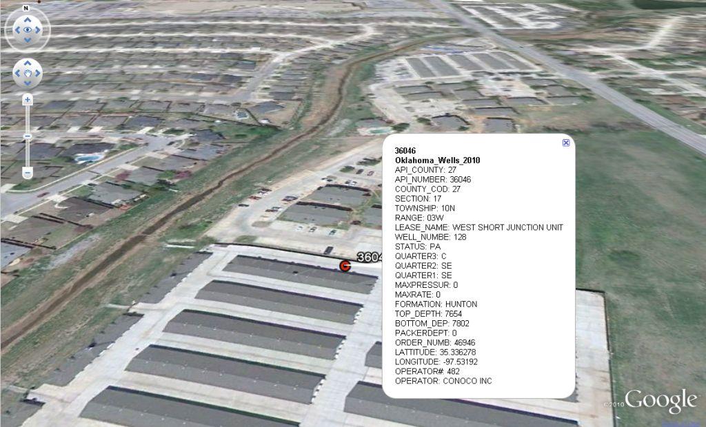
Related